ENGINEERING, DESIGN & CONSTRUCTION

Foundation Engineering & Design
Classification, density, compaction, CBR, shear strength, consolidation, permeability, and gradation testing.

Civil Works · Roads · Earthworks
Soil chemistry, water-quality analysis, contaminated-land assessments, and environmental compliance reporting.

Land Management
3D laser-scanned tank capacity tables, verticality and ovality verification, and storage-tank API certification support.

Document Management Solutions
Compressive strength, slump, mix design verification, Marshall stability, asphalt extraction, and core testing.

Remote Sensing & Image Processing
Remote CP monitoring with cellular telemetry — integrated into asset integrity dashboards.
Structural Assessment
ICAO-aligned ACN-PCN evaluation, runway structural assessment — DGCA and aerodrome submittal.

GIS Consulting & Roadmap
Boreholes, SPT, undisturbed sampling, cone penetration testing, dynamic cone penetrometer testing, and packer tests.

Application Development (Web · Mobile)
Enterprise GIS architecture, spatial workflow design, application development, and managed services with 24×7 helpdesk.

BIM & 3D Modeling
Classification, density, compaction, CBR, shear strength, consolidation, permeability, and gradation testing.
Managed GIS Services (24x7)
3D laser-scanned tank capacity tables, verticality and ovality verification, and storage-tank API certification support.

Enterprise GIS Integration
Soil chemistry, water-quality analysis, contaminated-land assessments, and environmental compliance reporting.
Geotechnical Engineering Reports
Compressive strength, slump, mix design verification, Marshall stability, asphalt extraction, and core testing.

Geoinformatics & GIS Solutions
Ultrasonic testing, radiographic testing, magnetic particle, dye penetrant, and concrete NDT (Schmidt hammer · UPV).
Spatial Data Conversion
Image processing, satellite imagery interpretation, vectorization, cartography, and basemap production at any scale.

Smart Governance Enablement
Compressive strength, slump, mix design verification, Marshall stability, asphalt extraction, and core testing.

Cartography & Map Production
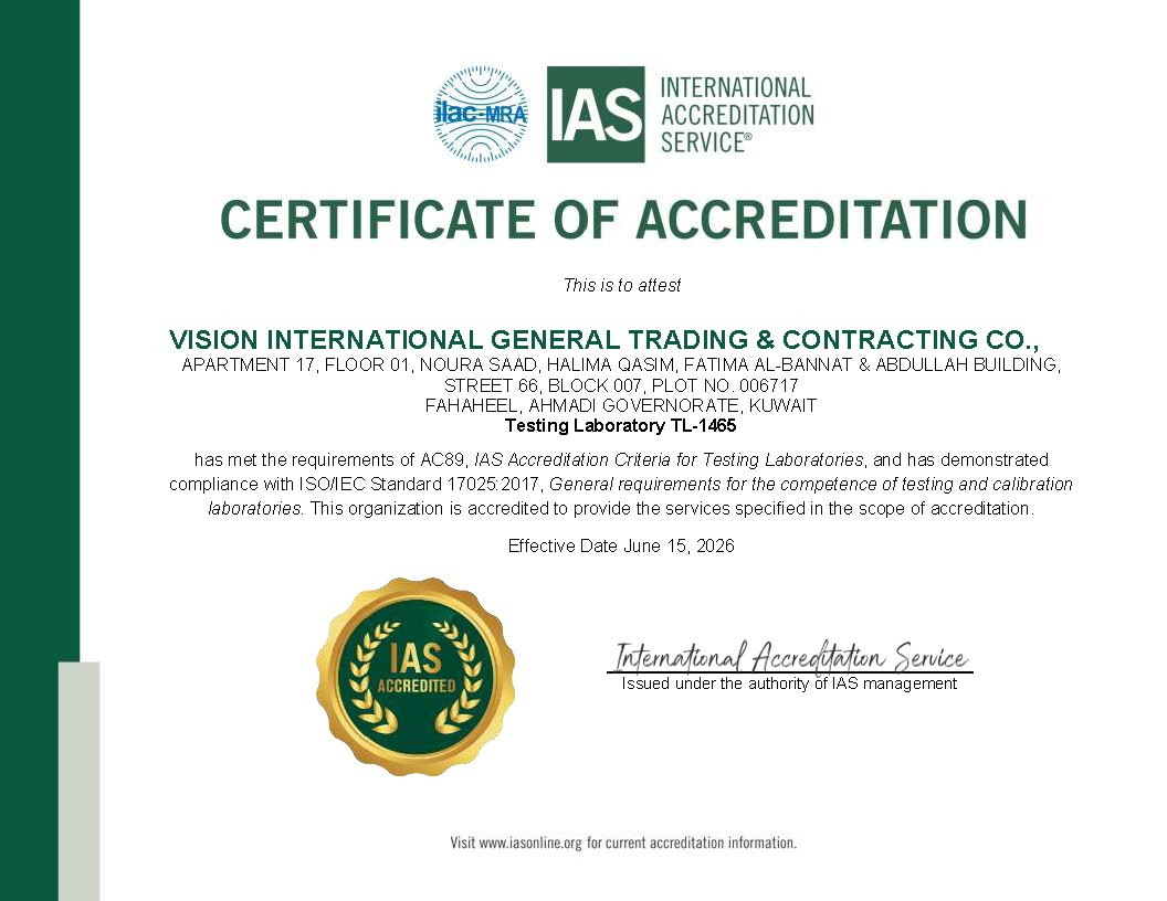
Survey instrument calibration, weighing equipment, force/torque, temperature, and dimensional metrology — all ISO 17025.