Frequently Asked Questions
Need answers before you start your next project?
Explore our most frequently asked questions about Vision International, our services, our technical capabilities, and how we support projects across Kuwait and the GCC. From surveying and geotechnical investigations to GIS, marine services, laser scanning, and engineering support, this page is designed to help you find clear answers quickly and confidently.
Frequently Asked Questions
About Vision International
1) Who is Vision International?
Vision International is a premier Kuwaiti engineering firm established in 2004. Specifically, we deliver integrated solutions across surveying, geotechnical investigations, geoinformatics, lab testing, and specialized field services. As a result, we successfully support major clients with technically rigorous solutions for infrastructure and oil & gas projects.
2) Where is Vision International located?
Our registered sales office is centrally located at Office 17, 1st Floor, South Tower, Al-Hashan Commercial Complex, Fahaheel, Kuwait. Additionally, we run an operations office in Mahboula. This second location allows our field teams to deploy rapidly and support projects nationwide.
3) How can I contact Vision International?
We offer multiple communication channels depending on your needs. For instance, you can use the following directory:
Tenders & Commercial: sales@visionkuwait.com
General Support: info@visionkuwait.com
Direct Phone: +965 22289778 / +965 96963477
4) What sectors does Vision International serve?
We serve diverse industries using a multi-disciplinary model. For example, we regularly support oil & gas facilities, heavy utility networks, marine ports, industrial parks, and government infrastructure programs. Therefore, clients can manage multiple project needs through a single partner.
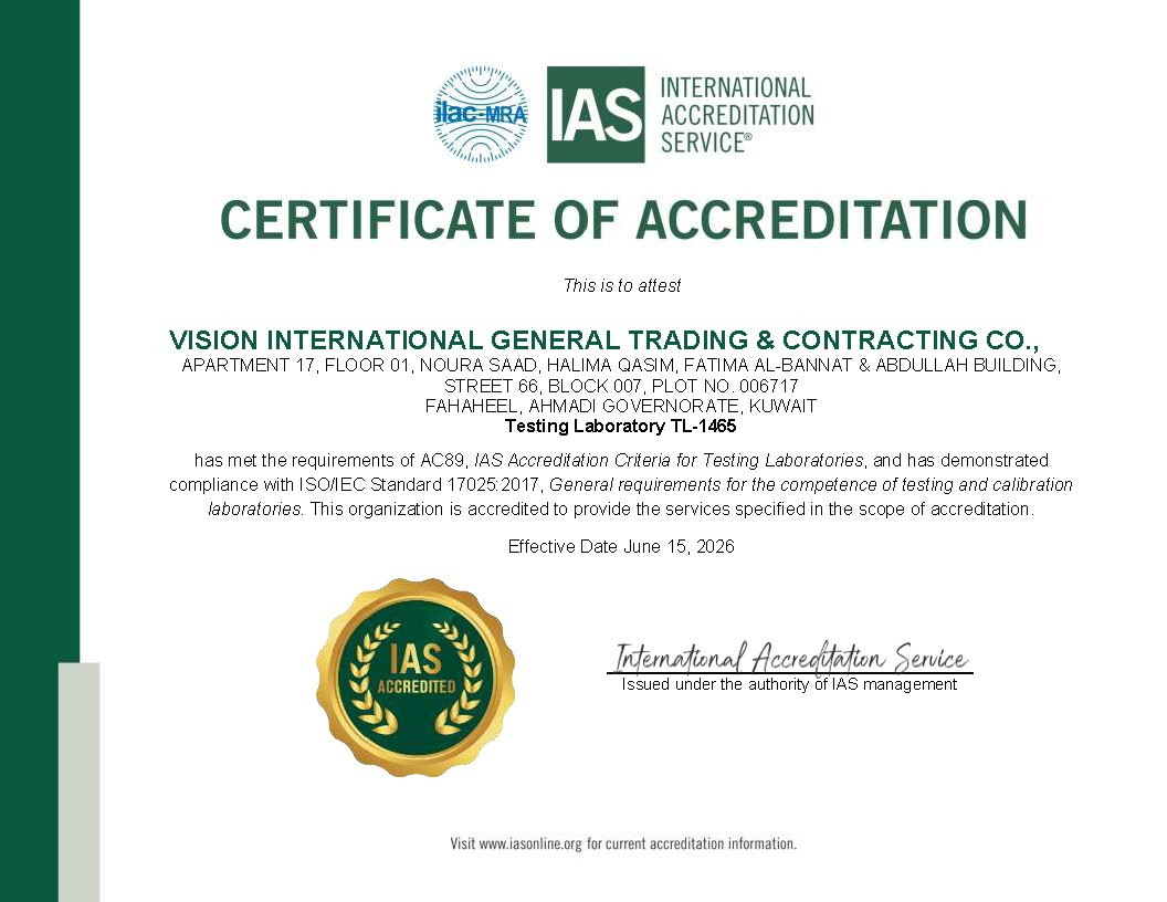
5) What certifications and quality standards do you work to?
Safety and precision are our highest priorities. Consequently, our laboratory and field operations strictly comply with premium international standards:
| Certification | Focus |
| ISO 9001 / 14001 / 45001 | Quality, Environment, Health & Safety |
| ISO 20000-1 / ISO/IEC 17025 | IT Services & Testing Lab Competence |
6) Why do clients choose Vision International?
In short, clients choose us because we minimize coordination gaps. We house advanced owned equipment, certified labs, and engineer-led field crews under one roof. Furthermore, this centralized approach accelerates project schedules and improves data accountability.
Surveying & Geotechnical Services
7) What are the best GNSS systems for accurate land surveying in Kuwait?
For high-precision work, we recommend survey-grade RTK GNSS systems backed by an active network. Accordingly, we operate a nationwide VRX/VRS network that supports major brands. This network consistently enables centimeter-level positioning data across the country.
8) Do you provide construction setting-out and as-built surveying?
Yes, we do. Our team provides precise structural setting-out, dimensional checks, verticality surveys, and final as-built data. Therefore, contractors can maintain tight project tolerances and satisfy strict engineering reviews.
9) How quickly can you mobilize survey or site investigation teams?
We are structured for rapid deployment. For example, our crews meet demanding timelines with these standard mobilization speeds:
RTK GNSS Field Crews: Mobilized within 48 hours.
UAV Aerial Mapping Teams: Mobilized within 72 hours.
Marine & Offshore Assets: Deployed on short notice, subject to permits.
10) What is the standard process for geotechnical soil testing?
Our certified testing framework follows a highly structured, four-step sequence:
Scoping: First, we plan the site investigation based on project parameters.
Fieldwork: Next, our teams perform drilling, soil sampling, and testing.
Lab Analysis: Subsequently, we test the samples inside our accredited laboratory.
Reporting: Finally, our engineers interpret the data and issue a formal report.
11) What are the best practices for soil improvement in construction?
Effective soil improvement depends entirely on detailed ground data. Depending on your soil profile, we may execute vibro-compaction, stone columns, jet grouting, or dewatering. In addition, we always perform post-treatment verification testing to ensure the ground meets structural requirements.
12) Do you provide offshore and marine geotechnical investigation services?
Yes, we offer fully integrated marine geotechnical solutions. In particular, our capabilities include marine boreholes, offshore Cone Penetration Testing (CPT/CPTu), and seabed sampling. These tools safely support port developments and subsea pipeline projects.
13) How can marine survey data improve coastal construction safety?
Marine survey data identifies hidden seabed hazards, charts sediment movement, and maps bathymetry before construction begins. Ultimately, this detailed mapping lowers financial and execution risks for marine builders.
14) How long does a soil test take in Kuwait?
A standard geotechnical soil investigation typically takes 7 to 10 working days from site drilling to the final engineering report. This includes 1–2 days of on-site borehole drilling, followed by 5–7 days of physical and chemical analysis inside our accredited laboratory to assess soil bearing capacity and salinity profiles common to Kuwait’s terrain.
15) What does a topographic survey cost?
The cost of a topographic survey in Kuwait varies depending on the total plot area (acreage), the complexity of existing structures, and the required detail density. Basic residential or commercial plots start around KWD 150 to KWD 300, while large-scale infrastructure or oil & gas corridors require custom quotes based on project scope and mobilization timelines.
16) Do you cover all areas of Kuwait for field surveys?
Yes, Vision International provides full national coverage across all six governorates of Kuwait. Thanks to our operational logistics base in Mahboula, our survey crews and drilling rigs deploy rapidly to northern projects (such as Subiya and Abdali), southern energy hubs (including Wafra, Ahmadi, and Mina Al-Ahmadi), and central urban development zones.
17) Can you help obtain Municipality (Baladiya) and KOC permits for surveying?
Yes. We assist clients through the regulatory pathway by providing the certified equipment calibrations, engineering signatures, and precise boundary descriptions required by the Kuwait Municipality, the Ministry of Public Works (MPW), and the Kuwait Oil Company (KOC) for excavation and survey clearances.
Geoinformatics, GIS & Reality Capture
18) What are the key benefits of using GIS for urban planning in Kuwait?
Geographic Information Systems (GIS) replace static paper maps with interactive spatial databases. As a result, urban planners can visualize utility layouts instantly. This real-time visibility effectively prevents design conflicts during infrastructure expansions.
19) Can you develop custom GIS, web, or mobile applications?
Yes, our in-house developers build custom geospatial solutions. For instance, we design tailored GIS portals, executive web dashboards, and mobile field apps. Consequently, these tools help clients streamline field inspections and maximize data value.
20) How can I integrate laser scanning into my civil works workflow?
3D laser scanning generates immediate value during as-built verification, scan-to-BIM modeling, and clash detection. By capturing precise physical dimensions, we eliminate costly manual re-work during construction.
21) Can I automate data collection for structural engineering assessments?
Yes, you can easily automate monitoring by deploying geotechnical instrumentation, wireless data loggers, and telemetry. This hardware streams live information directly to cloud dashboards. Thus, project teams receive real-time visibility while reducing manual data errors.
22) Do you provide geotechnical instrumentation and real-time monitoring?
Yes, we install piezometers, inclinometers, and automated threshold alarms. These systems are ideal for deep excavations, tunnels, and embankments. Thus, project managers can monitor structural shifts and mitigate risks proactively.
23) Do you offer equipment rental, calibration, and technical training?
Yes, we fully support your internal team capabilities. Specifically, we offer flexible surveying hardware rentals, commercial equipment sales, calibration support, and professional technical training. Therefore, we serve as a comprehensive long-term partner for spatial technologies in Kuwait.
Still need help? Talk to our team.
Whether you need a quotation, technical advice, or support for an upcoming project, our team is ready to help. Contact us at info@visionkuwait.com or sales@visionkuwait.com, or call +965 22289778 / +965 96963477
Email Us