A Geotechnical survey is a planned investigation of the soil, rock and groundwater beneath a proposed development.
Why Is Geotechnical Investigation Important?
A geotechnical survey identifies subsurface conditions and determines how the ground is likely to respond to structural loads, excavation, groundwater changes and construction activity. A geotechnical investigation can help assess:
Soil and rock sequence and variability
Bearing capacity and settlement
Foundation type and founding depth
Excavation stability and dewatering requirements
Ground-improvement options
Liquefaction and seismic site conditions
Groundwater levels and pressures
Pipeline, cable, anchor and foundation interaction offshore
Ground conditions can vary considerably across a site. Weak soil, loose fill, shallow groundwater, cemented layers, cavities or variable rockhead may affect foundation performance and construction cost. When these conditions are identified early, the design team can select suitable solutions before work begins.
What is a Geotechnical Survey?
A Planned Investigation of soil, rock and groundwater.
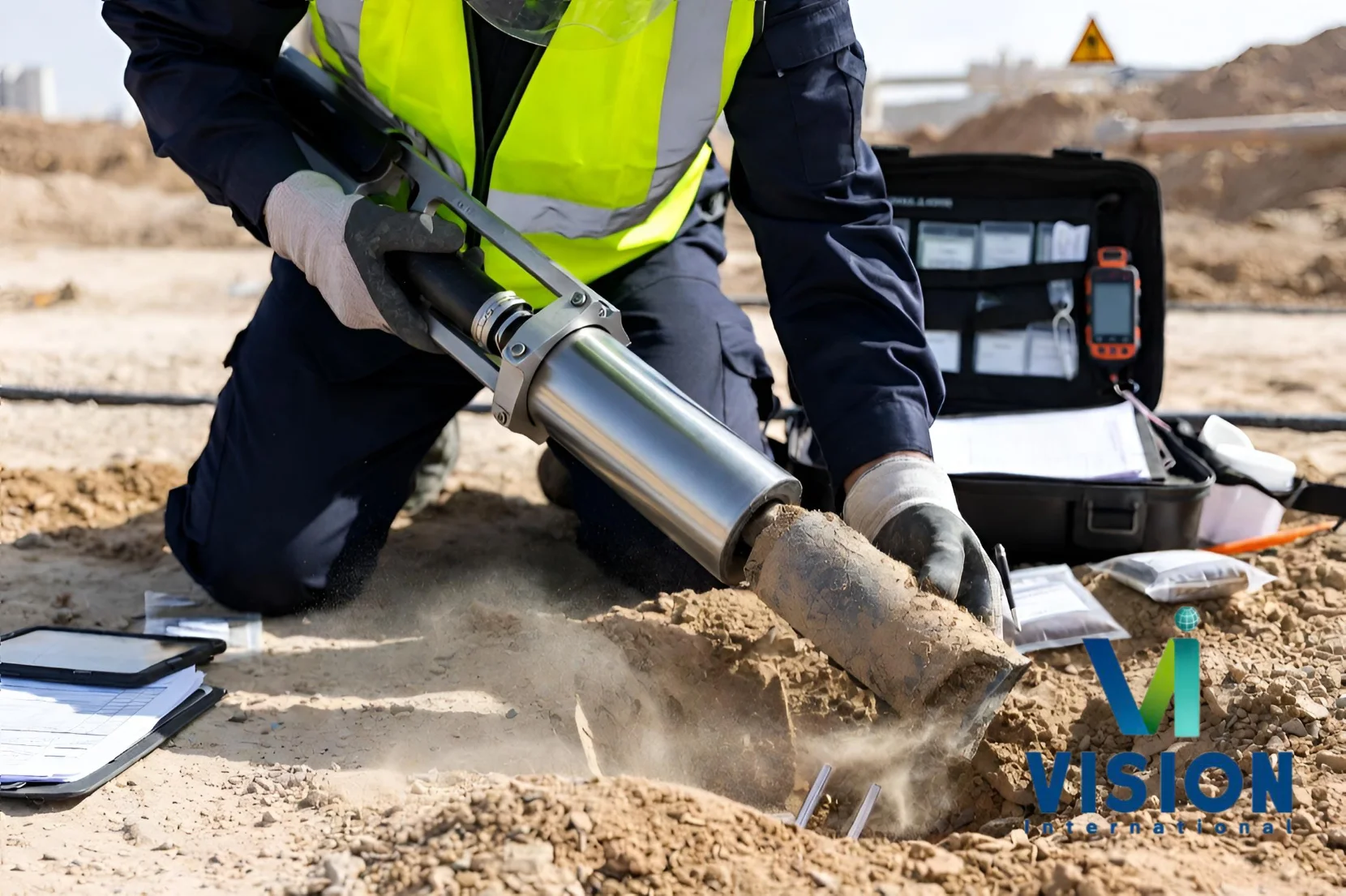
Geotechnical site investigation in progress, collecting critical soil and ground data to support safe and efficient engineering and construction projects.
A Geotechnical survey is a planned investigation of the soil, rock and groundwater beneath a proposed development. It provides the ground information engineers need to design foundations, excavations, earthworks, ground improvement and construction methods safely and economically.
The investigation may combine borehole drilling, soil and rock sampling, Standard Penetration Testing (SPT), Cone Penetration Testing (CPT or CPTu), field testing, geophysical measurements, groundwater monitoring and accredited laboratory analysis.
Vision International provides integrated onshore and offshore geotechnical investigation services across Kuwait and the GCC. Our capability includes land-based drilling and testing, marine boreholes from an owned jack-up barge, seabed investigation, laboratory testing and engineer-led reporting.
Geotechnical Survey
ONSHORE INVESTIGATION
Onshore geotechnical investigation using specialized drilling equipment.
Onshore investigation supports buildings, towers, roads, bridges, utilities, industrial plants, oil and gas facilities and government infrastructure. The programme is selected according to the proposed loads, excavation depth, foundation options and expected ground conditions.
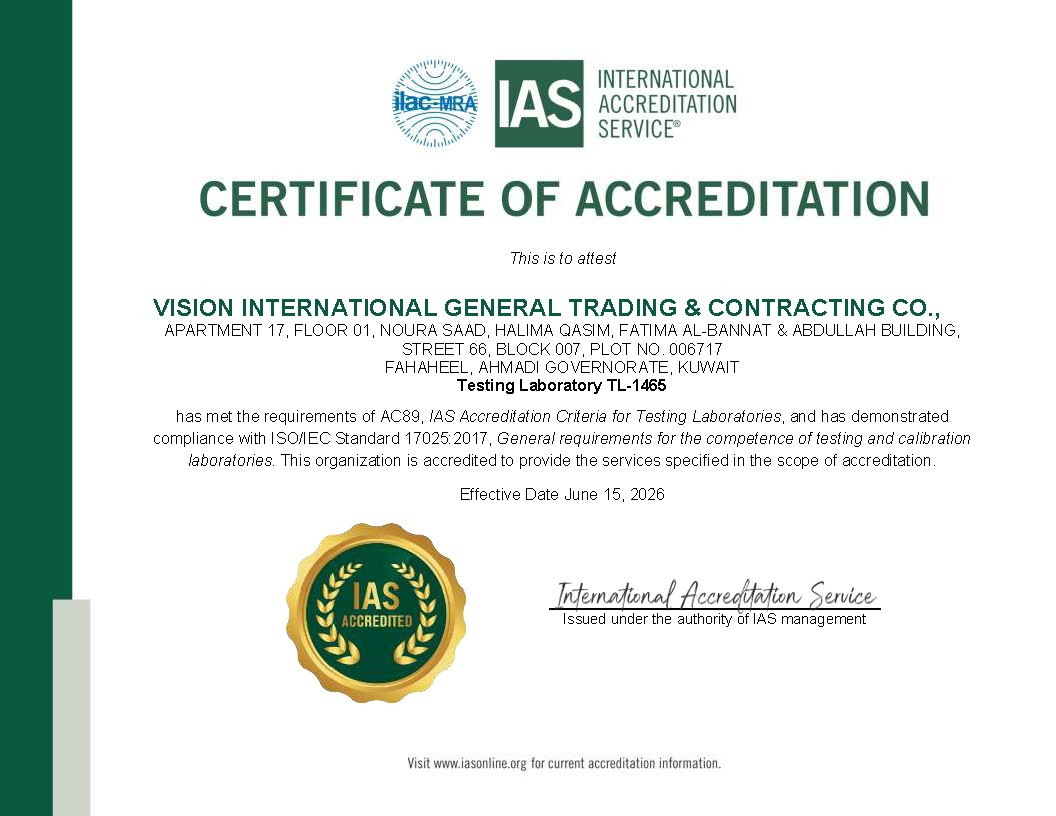
Vision International combines drilling crews, CPT and field-testing equipment, geophysical capability, groundwater monitoring and an ISO/IEC 17025 accredited laboratory within one integrated service.
Onshore geotechnical investigation using specialized drilling equipment to collect soil samples and evaluate subsurface conditions for construction and infrastructure projects.
Geotechnical Survey
OFFSHORE INVESTIGATION
Offshore investigation examines the seabed and sub-seabed for marine structures and subsea infrastructure.
Vision International operates an in-house marine geotechnical capability centered on an owned self-elevating jack-up barge and marine survey fleet.
Services include marine boreholes, offshore CPT/CPTu, seabed sampling, vibrocore and gravity core collection, piston sampling, pressure meter and vane testing, permeability testing and piezometer installation.
Geotechnical results can also be integrated with bathymetric, side-scan sonar and sub-bottom data.
Offshore geotechnical investigation conducted from a jack-up platform, providing essential seabed and subsurface data for the design, construction, and maintenance of marine and coastal infrastructure.
Geotechnical Survey
APPLICATION
Our Geotechnical investigations provide essential subsurface data for the safe, efficient, and cost-effective design of construction, infrastructure, marine, and industrial projects. For buildings and towers, geotechnical site investigations support foundation design, settlement assessment, groundwater evaluation, slope stability, ground improvement, and liquefaction assessment. Infrastructure projects such as roads, bridges, embankments, utilities, and earthworks benefit from borehole drilling, CPT/CPTu, in-situ testing, permeability testing, and soil characterization to establish reliable ground conditions. In oil, gas, and industrial developments, geotechnical investigations provide critical design information for foundations, process structures, buried services, site development, and other major facilities. For ports and marine terminals, marine boreholes, seabed sampling, offshore CPT/CPTu, and geotechnical testing support quay walls, breakwaters, berth areas, reclamation, and marine foundations. Submarine pipeline and cable investigations assess route conditions, trenchability, burial requirements, shore approaches, thermal resistivity, pipe-soil interaction, on-bottom stability, scour and erosion, while offshore platforms and mooring systems require geotechnical data for jacket foundations, monopiles, suction buckets, mooring anchors, and single-point mooring (SPM) systems.
Vision International’s integrated capabilities combine drilling, sampling, field testing, groundwater monitoring, accredited laboratory analysis, and specialist marine investigation to deliver comprehensive geotechnical data for projects across Kuwait, wider GCC and the Middle East.
Typical Geotechnical Survey Deliverables
A geotechnical investigation typically produces a set of technical deliverables that convert field and laboratory data into reliable information for engineering design and construction. Vision International’s workflow includes field investigation, ISO/IEC 17025 laboratory testing, and engineer-signed reporting, with deliverables interpreted for design rather than provided as raw data alone.
Borehole, trial-pit and core logs
SPT, CPT/CPTu and field-test results
Groundwater monitoring records
Laboratory test certificates and summaries
Geophysical profiles and interpreted sections
Ground model and geotechnical risk assessment
Foundation, earthwork, excavation and dewatering recommendations
Offshore pipe-soil, anchor or foundation parameters where required
Engineer-signed geotechnical report
How Does a Geotechnical Survey Work?
1. Planning The engineer reviews the proposed development, existing information, access conditions and design requirements, then prepares the investigation plan, method statement and HSE documentation. 2. Field investigation Crews drill and log boreholes, recover samples, perform in-situ tests and install groundwater instruments under engineering supervision. 3. Laboratory testing Selected soil, rock and water samples are tested using applicable procedures and controlled chain-of-custody. 4. Interpretation Field and laboratory results are combined to develop a ground model and derive suitable engineering parameters. 5. Reporting The final report presents the ground conditions, risks, test results and recommendations for design and construction.
How Vision International Performs a Geotechnical Survey
1. Project scoping
Review the development, existing data, ground risks, required parameters, access and programme. Prepare the borehole or test plan, permits, method statement and HSE package.
2. Mobilization
Deploy registered onshore rigs or the marine jack-up barge, testing equipment, crews, positioning resources and required permits.
3. Field investigation
Drill, log and sample boreholes; complete CPT/CPTu and other in-situ tests; install instruments; and maintain engineering supervision and quality records.
Receive samples under chain-of-custody, select relevant tests and perform analysis within the ISO/IEC 17025 laboratory scope.
5. Engineering interpretation
Develop the ground model, evaluate design and construction risks, derive parameters and prepare an engineer-signed report.
What are the Main Geotechnical Investigation Methods?
Borehole Drilling and Sampling
Boreholes provide direct information about subsurface layers. Vision International’s onshore capability includes rotary and sonic drilling, soil sampling, continuous rock coring and borehole logging, with onshore drilling capability stated up to 100 m. Offshore rotary and wireline drilling can be completed from the jack-up barge.
Standard Penetration Testing
SPT is carried out inside a borehole by driving a standard sampler into the ground and recording the number of blows required. The result provides an index of soil resistance and a disturbed sample for identification. Vision International offers SPT for onshore and marine boreholes.
CPT and CPTu
Cone Penetration Testing pushes an instrumented cone into the ground at a controlled rate. CPT records tip resistance and sleeve friction, while CPTu also measures pore-water pressure. The continuous profile helps identify changes in soil behavior and thin layers. Vision International provides onshore, seabed and down-hole CPT/CPTu services.
In-Situ Field Testing
Depending on the project, field testing may include plate load tests, field CBR, permeability tests, field density, pressuremeter testing, Dynamic Cone Penetration, electrical resistivity and thermal-resistivity profiling.
Geophysical and Seismic Testing
Geophysical methods help extend the ground model between direct investigation points. Available methods include downhole and crosshole seismic testing, MASW, seismic refraction and reflection, electrical resistivity and Ground Penetrating Radar.
Groundwater Monitoring
Groundwater influences excavation, dewatering, uplift, seepage and durability. Standpipes, monitoring wells and vibrating-wire piezometers can be installed for short-term or long-term measurement and groundwater sampling.
Why Choose Vision International for Geotechnical Surveying?
Integrated delivery: Field crews, equipment, senior engineers and an accredited laboratory are coordinated under one organization. Onshore and offshore capability: Services extend from land-based boreholes and CPT to marine drilling and seabed testing from a jack-up barge. Engineer-led reports: Results are interpreted for design and presented in an engineer-signed report rather than delivered only as raw data. Regional coverage: Vision International has operated since 2004 and provides geotechnical services across Kuwait, the GCC and Middle East.
Need a Geotechnical Survey for a Project?
Planning a building, industrial facility, road, port, pipeline, offshore platform or marine terminal? Vision International can prepare an investigation scope based on your project, site conditions, access, required parameters and programme.